A First in West Africa: Aerial photographic survey of the large fauna of the Comoé National Park assisted by Artificial Intelligence

Aerial surveys of large fauna in open areas (such as savannas) are one of the essential methods for assessing the conservation status of national parks and nature reserves. These surveys help adjust management measures accordingly. Traditionally, these surveys are conducted with two rear observers aboard a CESSNA-type aircraft, following the standards of the "Monitoring the Illegal Killing of Elephants" (MIKE) program of the Convention on International Trade in Endangered Species of Wild Fauna and Flora (CITES).
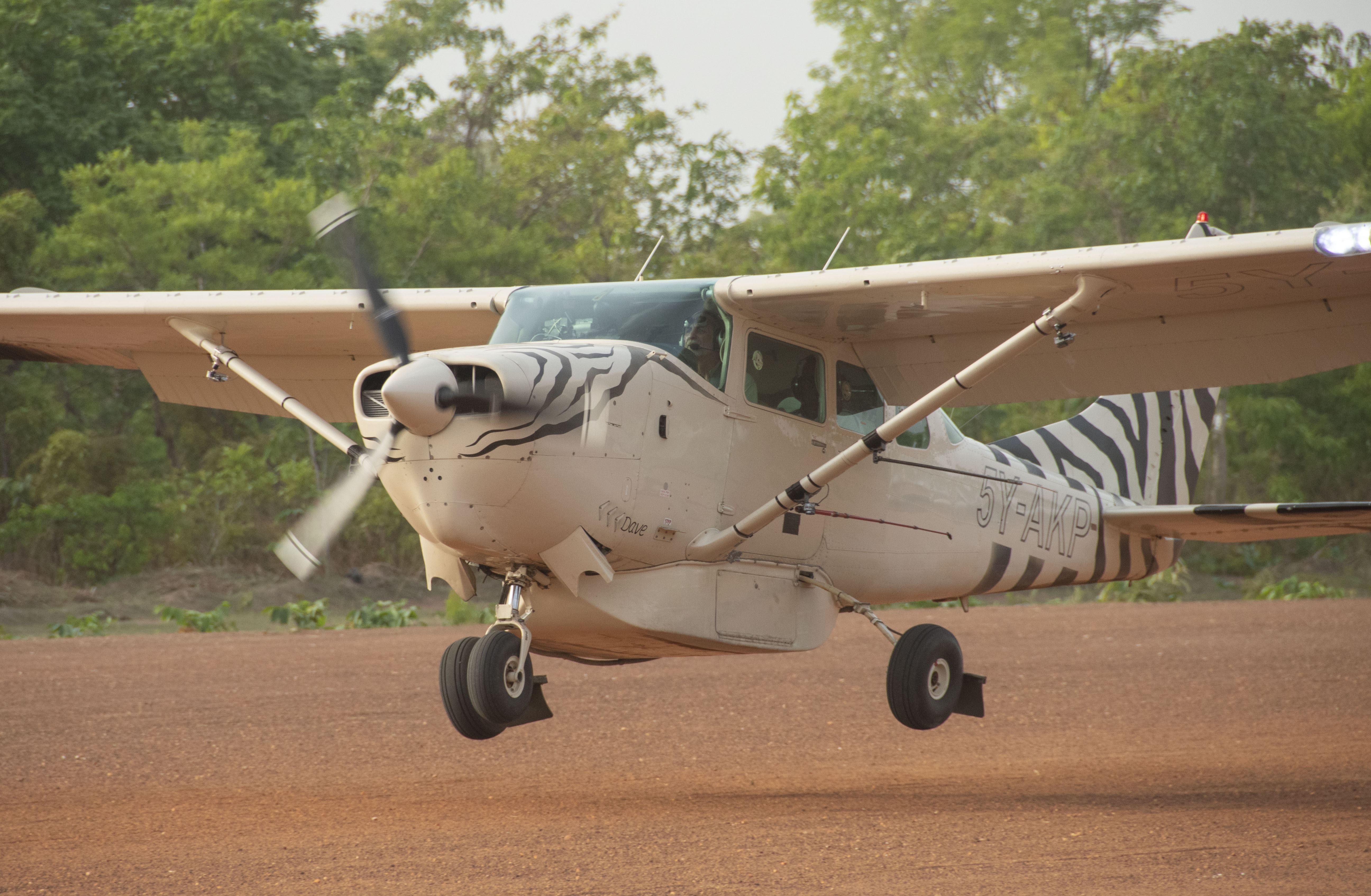
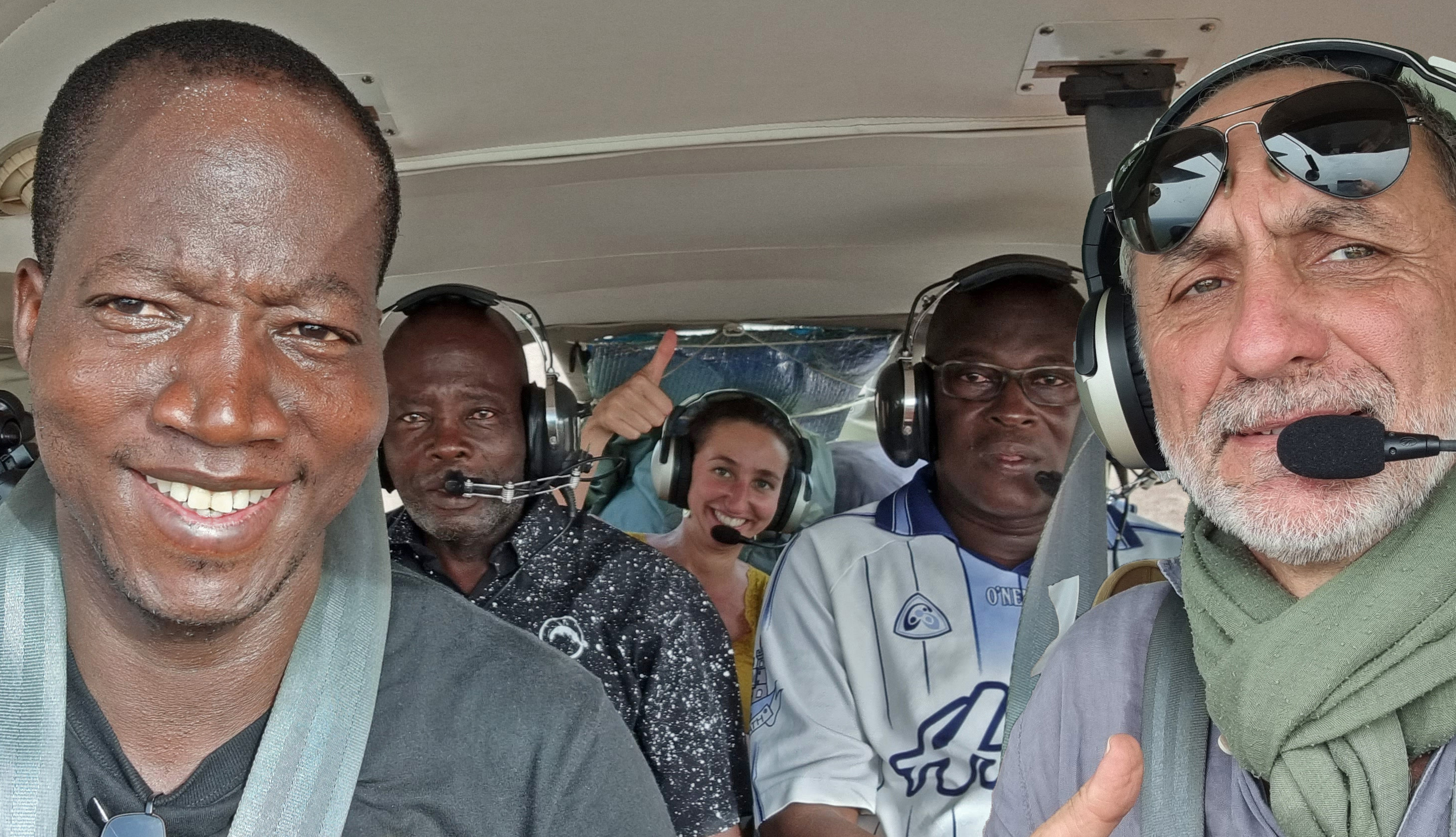
Although this method has been refined for over 60 years and is widely used in Africa, it has some disadvantages. These include the high risk faced by the flight team, the high logistical costs, and inaccuracies in wildlife observations.
In recent years, many conservation actors have demonstrated that aerial photographic surveys could be a promising alternative, particularly with the improvements in the accuracy of wildlife population estimates (Lamprey et al., 2020). However, a major challenge related to the use of this technology is the high cost of the significant human effort required for the manual processing of photographs.
To overcome this limitation and significantly reduce the time required for analyzing aerial photographs, Gembloux Agro-Bio Tech (University of Liège) developed an artificial intelligence algorithm, named HerdNet. After being trained to recognize each species, this algorithm is capable of automatically detecting and identifying animals in the photos taken during the flights. Aviation Sans Frontières Belgium, through its Conservation From the Sky program, has been closely collaborating with this university since 2021 to develop a method for aerial photographic surveys assisted by this algorithm.
The field experiment was conducted during the 2022 aerial survey of large fauna in the Comoé National Park, carried out by the Ivorian Office of Parks and Reserves (OIPR) as part of the Comoé National Park Biodiversity Protection Project, co-financed by KfW - Development Bank. It demonstrated the effectiveness of this method of aerial photographic surveys assisted by artificial intelligence.
The Comoé National Park, in Ivory Coast, covers more than 11,148 km², consisting of a mosaic of savannas and forests. The 2022 aerial survey combined the approach with onboard observers and aerial photography. Since these two methodologies covered exactly the same areas, a comparison between the observations of the two methods is possible.
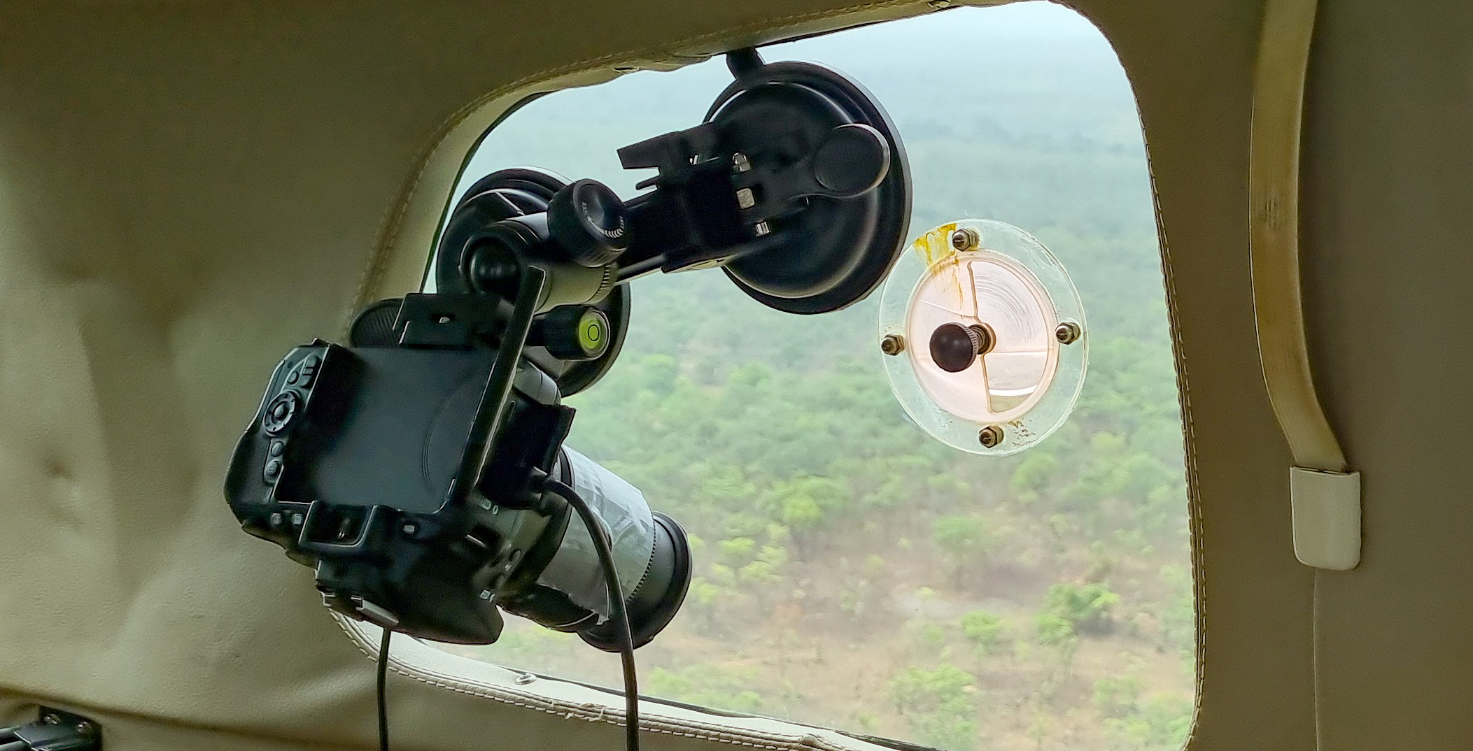
The HerdNet model, previously trained on images from Uganda, was used to speed up the processing of 148.239 survey photos. A significant part of the work involved refining the model's training for the wildlife species and environment of the Comoé National Park.
The results of this experiment were published in a scientific article by Delplanque et al. on June 8, 2024, in the journal Ecological Informatics, under the title 'Will artificial intelligence revolutionize aerial surveys? A first large-scale semi-automated survey of African wildlife using oblique imagery and deep learning.' In addition to Alexandre Delplanque and Julie Linchant from the University of Liège Gembloux Agro-Bio Tech, Colonels KOUADIO Yao Roger and OUATTARA Amara, respectively Director of the North-East Zone and Head of Ecological Monitoring in the same Directorate in charge of the Comoé National Park, and Xavier Vincke, Director of Programs at Aviation Sans Frontières Belgium, are also co-authors of this article.
Link to the scientific article, in the journal Ecological Informatics : link to the article
This experiment conducted at the Comoé National Park in 2022 presents three advantages of the aerial photography approach with Deep Learning:
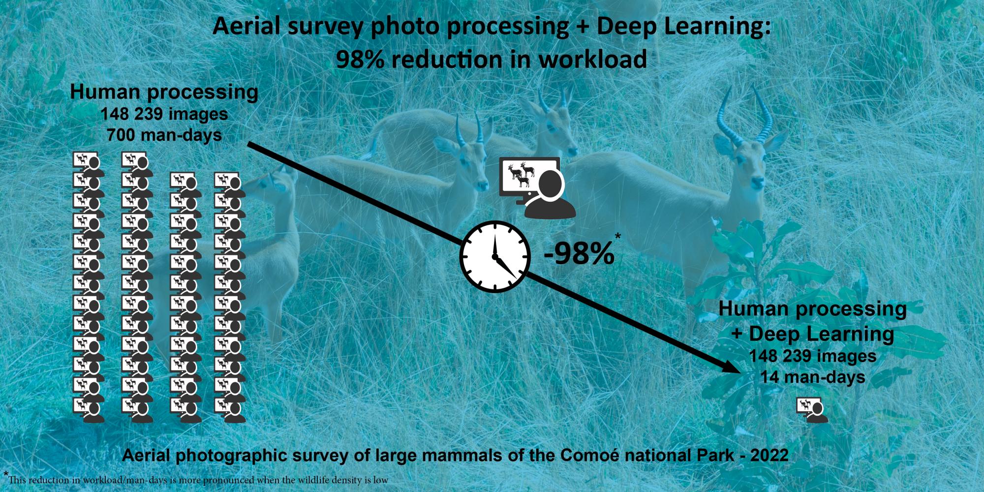
- A 98% reduction in the human effort required for manual photo processing.
- A significant improvement in population estimates for certain species, such as kobs and warthogs.
- An improvement in the accuracy of population estimates for the species photographed during the survey.
1. 98% reduction in the human effort required for manual photo processing
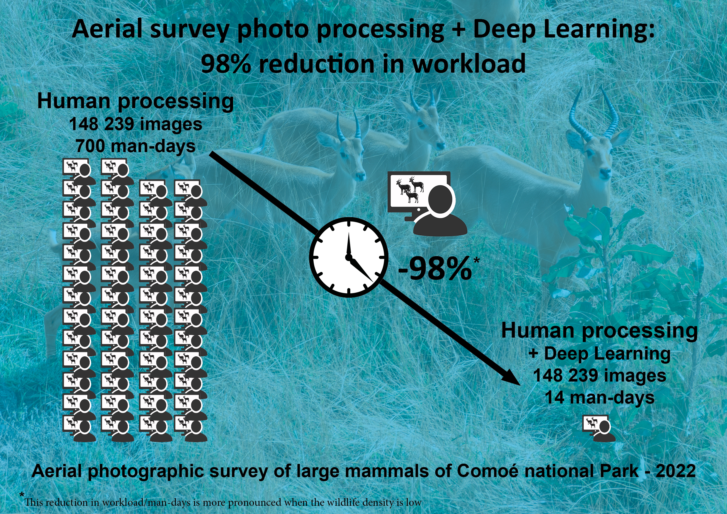
This experiment addressed the major challenge of the aerial photographic survey method : the human effort involved in processing aerial photographs was reduced by 98% thanks to the use of Deep Learning. Deep Learning (DL), a subcategory of artificial intelligence, uses artificial neural networks to perform complex tasks (e.g., detecting animals in aerial images). While previously a team of around ten people would be mobilized for several weeks, or even months, to analyze all the photos from the survey, this task is now entrusted to a single observer. This observer is responsible for supervising the training of the model and verifying and correcting its detections. The process is also much less time-consuming, given the model’s ability to filter out images that do not contain animals. It is worth noting that this time-saving in processing is even more significant given the low wildlife density in the protected area.
2. Significant improvement in the population estimation of certain animal species, such as kobs and warthogs
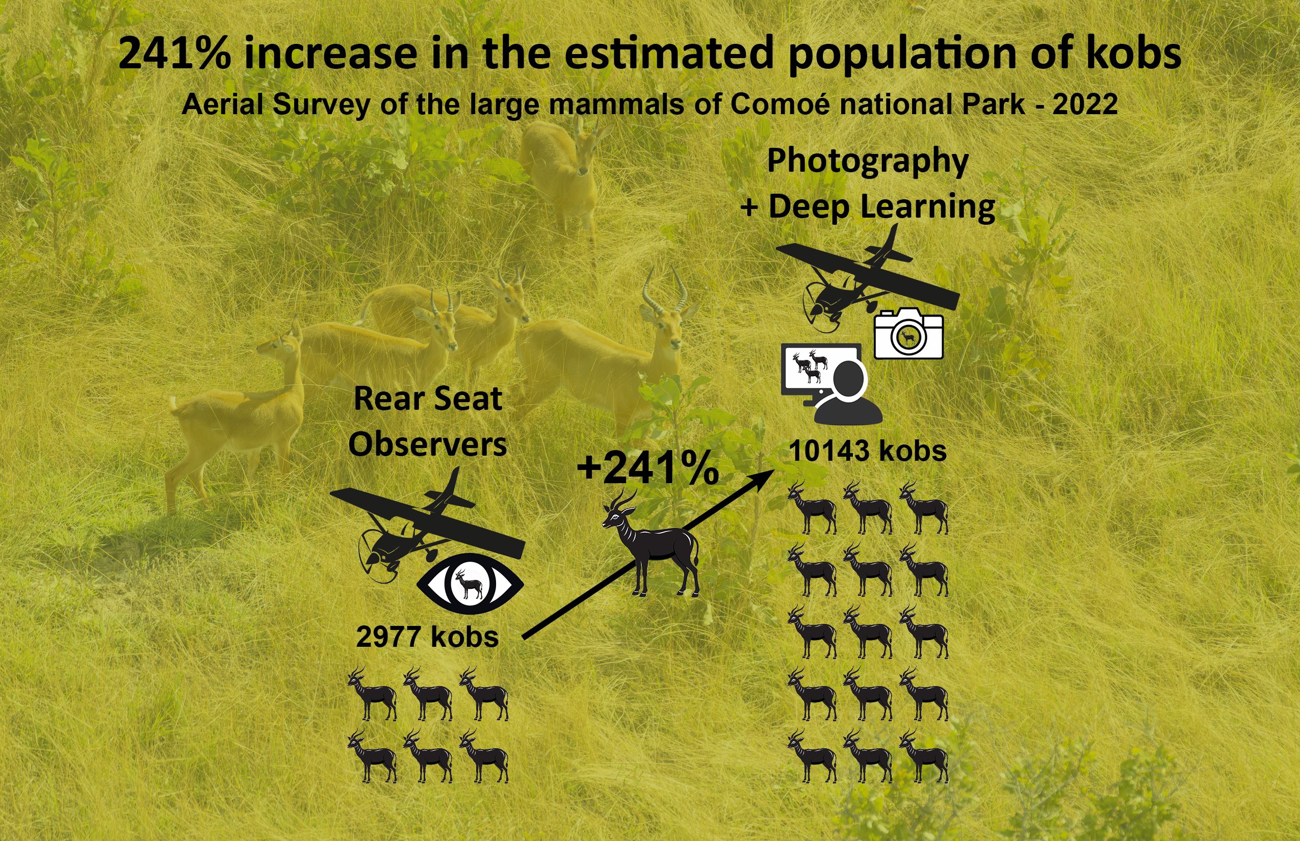
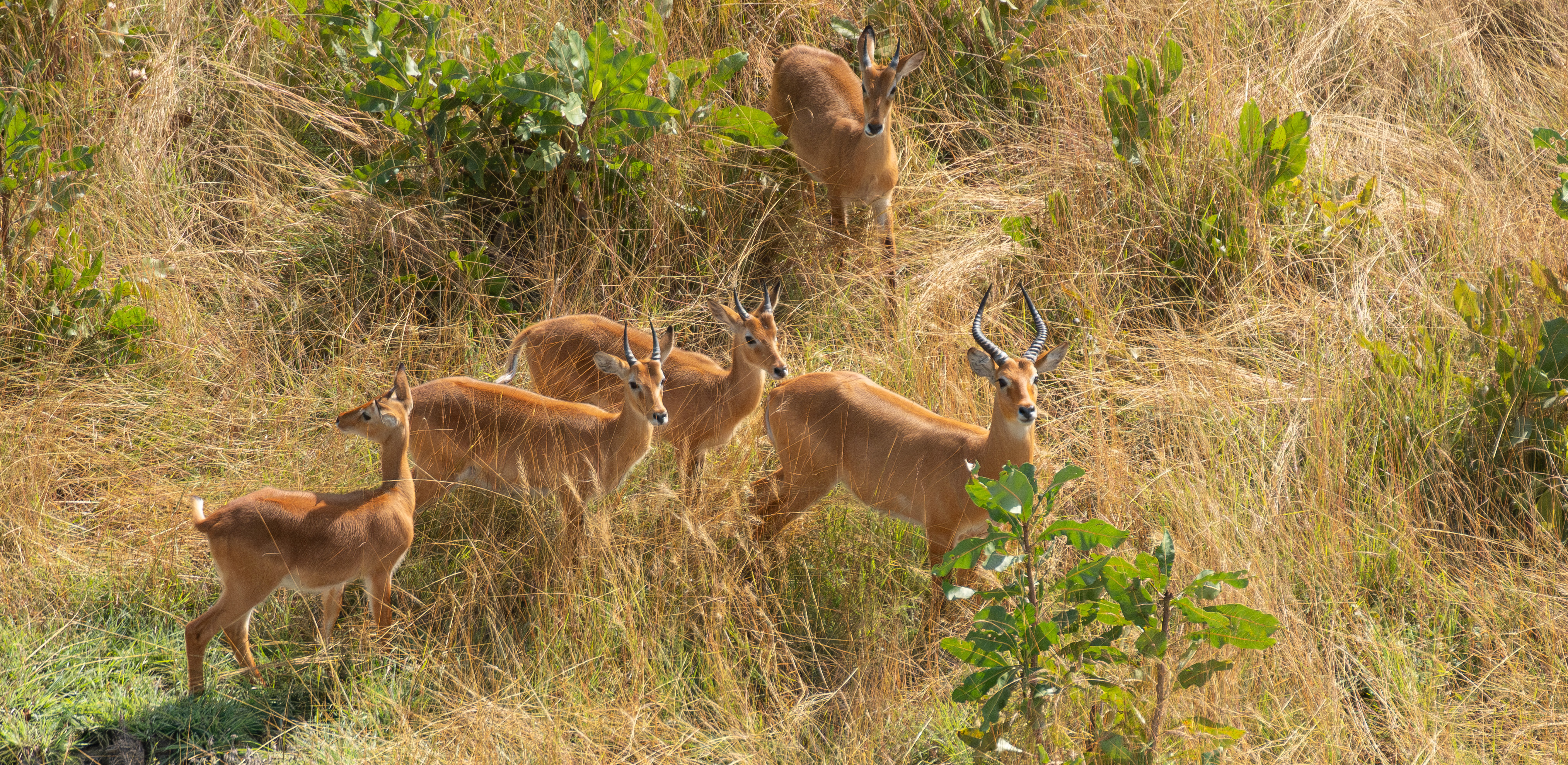
The statistical analysis revealed that the estimates from this aerial photographic survey method assisted by artificial intelligence were significantly higher for smaller species, such as kobs (Kobus kob kob) (+241%) and warthogs (Phacochoerus africanus) (+163%), and comparable for other key species, in comparison with the traditional aerial survey method with rear seat observers.
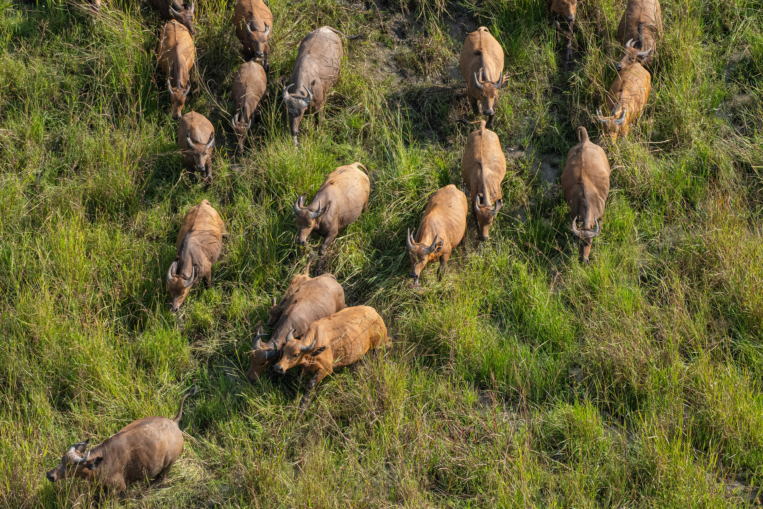
Apart from the fact that these species are small in size compared to other targeted species, it is important to note that their behavior during the aircraft's passage significantly reduces the likelihood of them being observed by the survey team. While species such as the hartebeest (Alcephalus buselphalus major), buffalos (Syncerus caffer brachyceros), or roan antelopes (Hippotragus equinus koba) tend to flee when the aircraft passes, making them easier to observe, kobs and warthogs tend to remain stationary.
3. Improvement in the accuracy of population estimates for the species photographed during the survey
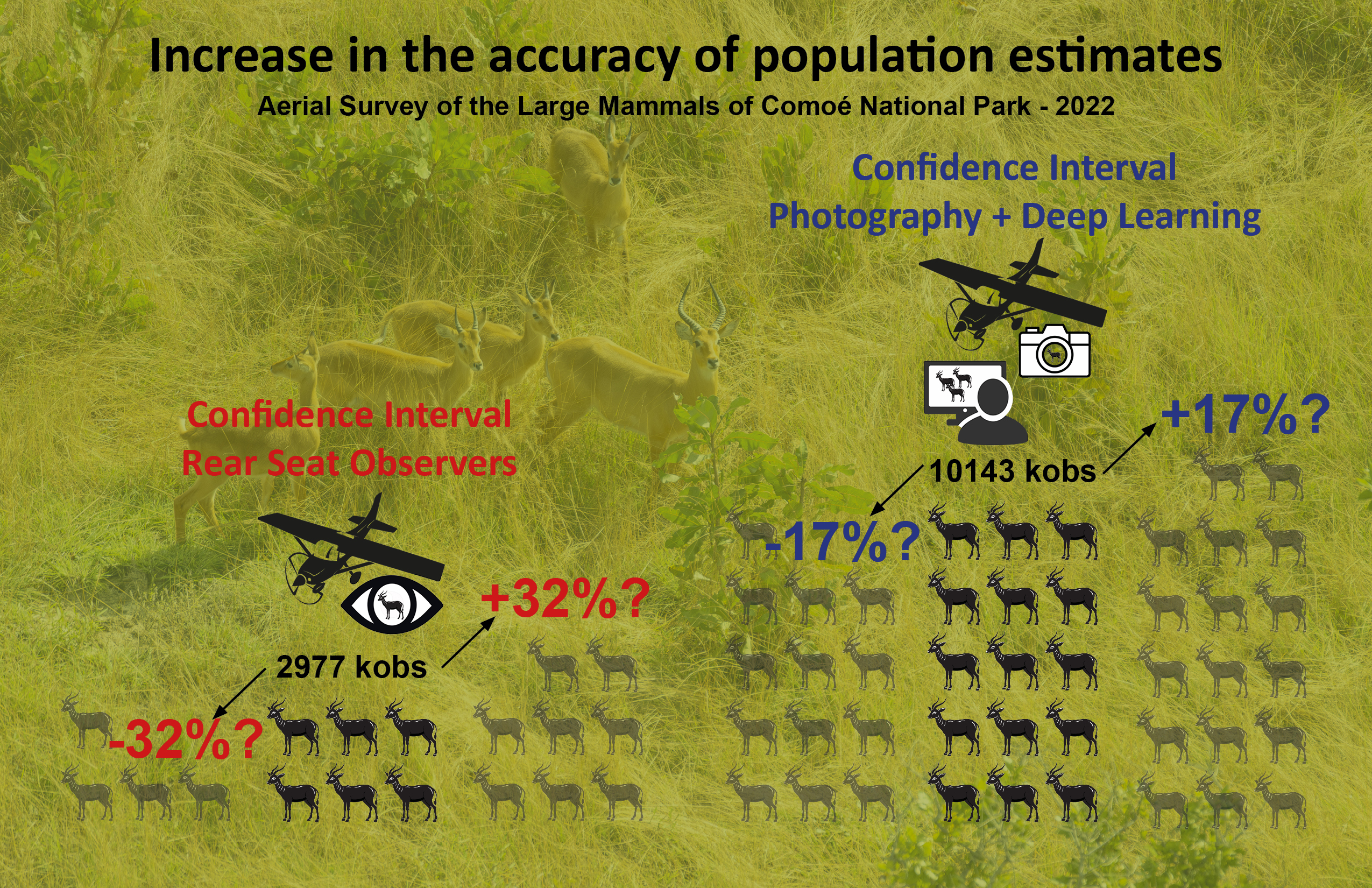
Due to the increase in the number of individuals counted and more consistent numbers across the entire survey area, the confidence intervals are greatly reduced for kobs and warthogs, which demonstrates greater accuracy in the estimates using the approach combining aerial photography and Deep Learning.
Perspectives
The advantages of this innovation, compared to traditional surveys with rear seat observers, are numerous:
- Increased accuracy (species identification and population estimates).
- Economic benefits, with the possibility of conducting aerial surveys using microlight aircrafts.
- Improved safety with the ability to fly at twice the altitude.
The approach combining photographic surveys and Deep Learning enables effective and cost-efficient inventories, thus opening the possibility of conducting aerial surveys in microlight aircrafts.
Many national parks have one or more two-seat microlight aircrafts. In contrast, few national parks own a 4- or 6-seat airplane. Microlight aircrafts are much more economical. Their purchase price is up to ten times lower than that of a 6-seat airplane like the Cessna 206. The maintenance costs of microlight aircrafts are more affordable, and the fuel cost per flight hour is five times lower than that of a Cessna 206.
The use of aerial photography allows for higher altitude flights by equipping the cameras with longer focal lengths, which enhances flight safety. Furthermore, microlight aircrafts can easily be fitted with parachutes, further increasing flight safety.
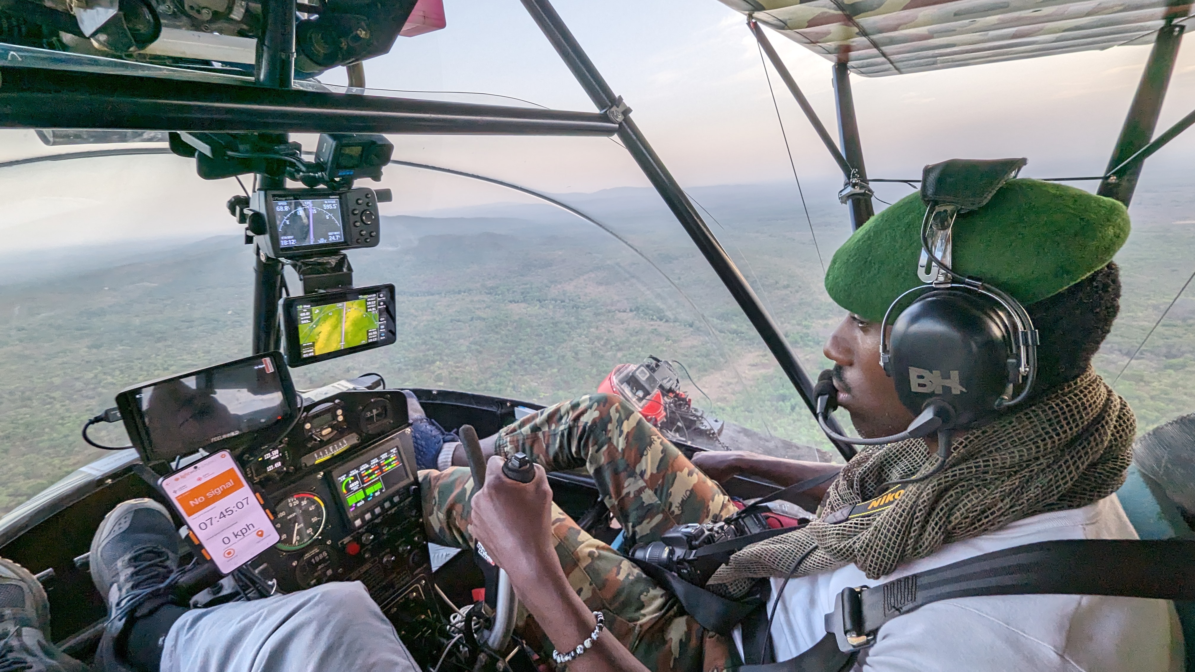
Coupling cameras with inertial measurement units (IMUs), in addition to GPS, to continuously record the aircraft's position variations is one of the critical steps currently being tested. This allows for the projection of images onto the ground, in order to obtain more accurate sampled surface estimates and to compensate, in particular, for the lower flight stability of microlight aircraft (ULMs) compared to airplanes.
Conclusion
This innovative approach, combining photographic surveys and artificial intelligence, provides more reliable wildlife population estimates, thus allowing for better management of the protected area in question to safeguard this heritage.
The use of microlight aircrafts, with their reduced operational costs, will also increase the frequency of surveys, further enhancing wildlife conservation efforts.
A national park with abundant wildlife ensures the development of tourism, generating significant economic benefits for the local communities surrounding the park. This improvement in living standards helps increase community involvement in the conservation of natural resources.
Acknowledgments
We wish to express our deep gratitude to the authorities of Ivory Coast for their support, which made it possible to conduct these surveys in Comoé National Park. We particularly thank the Ministry of Environment and Sustainable Development as well as the Ivorian Office of Parks and Reserves (OIPR), and especially the North-East Zone Directorate (DZNE), for their administrative and technical support on the ground. We also express our gratitude to the Ministry in charge of Civil Aviation.
Our special thanks go to General Conservator TONDOSSAMA Adama, Director General of OIPR, and Colonel KOUADIO Yao Roger, Director of the North-East Zone of OIPR and head of the Comoé National Park biodiversity conservation project. We also wish to express our gratitude to Mr. Amara OUATTARA, Head of Ecological Monitoring and GIS for Comoé National Park, for his availability and his role as ground coordinator of the project.
We also extend our thanks to the AHT Group team in Germany and Côte d'Ivoire, especially Mr. Matteo CANTORO for his invaluable assistance and technical and administrative support, which were essential to the smooth execution of the survey operations, and Mr. Eric VERCAUTEREN for his support in the current Aviation Sans Frontières project that enabled the completion of the analyses and report.
We express our appreciation to Gembloux Agro-Bio Tech, particularly to Professor LEJEUNE Philippe and Alexandre DELPLANQUE for their important work on processing photographic data and refining the training of the counting algorithm. We also warmly thank all the interns from the University of Liège Gembloux Agro-Bio Tech who contributed to this work, such as Loïc EISENDRATH.
Thanks to Jean-Pierre D’HUART for initiating this exciting collaboration between OIPR, Aviation Sans Frontières, and the University of Liège Gembloux Agro-Bio Tech.
We express our gratitude to Ms. Julie LINCHANT, independent expert in aerial wildlife surveys, for organizing the surveys, acquiring the photographic inventory data, assisting the front seat observer, and for writing the various reports that contributed to the preparation of this report.
We also thank the following individuals for their essential contributions to the realization of these surveys:
- Alexis PELTIER, pilot and owner of the aircraft specially equipped for wildlife surveys, with over 40 wildlife surveys to his credit. Alexis traveled from Nairobi with his aircraft registered in Kenya.
- Amara OUATTARA, ecological monitoring manager of Comoé national Park.
- Nounifou SABDANO, front seat observer, responsible for collecting and analyzing the inventory data.
- AYEBY Théophile, OIPR member, left rear seat observer.
- KOFFI KOUASSI Yves Constant, OIPR member, right rear seat observer.
- AMONAN BODA Hyacinthe, OIPR member, substitute rear observer.
Mr. Moustapha DIABY from the Abidjan Aeroclub, who provided crucial support during the administrative and logistical process, is warmly thanked.
We thank the Uganda Conservation Foundation (UCF), Dr. Richard LAMPREY, and once again Alexandre Delplanque for the use of their wildlife detection model, developed in 2022 using data collected during the photographic survey. This model was trained on oblique aerial images of the Queen Elizabeth Protected Area (Uganda), acquired in September 2018, with the aerial survey funded by UCF.
Thanks to Howard FREDERICK, Conservation Biologist, expert in aerial surveys, Research Associate, Tanzania Wildlife Research Institute, PhD candidate at Groningen University, for his technical support.
Thanks to Terry PAPPAS - Managing Director Micro Aviation S.A. - For his judicious advice for the realization of photographic surveys in Bat Hawk aicraft. Thanks to the pilot Stéphane CARRE for his participation in the aerial surveys tests in Bat Hawk aircraft. As part of these Bat Hawk aucraft tests, thanks to Baptiste Bataille, Anthony Caere from Virunga National Park and Derek Macpherson for their advice.
Thanks to Henri PEUCH from the Abidjan Aeroclub for his valuable advice and help.
To all the individuals whose names could not be mentioned but who provided valuable assistance in carrying out this survey, we extend our sincere thanks.
References
CITES-MIKE. (2020). Monitoring the Illegal Killing of Elephants: Aerial Survey Standards for the MIKE Programme. Version 3.0. Convention on International Trade in Endangered Species - Monitoring the Illegal Killing of Elephants Programme (CITES-MIKE), Nairobi, Kenya.
Delplanque, A., Linchant, J., Vincke, X., Lamprey, R., Théau, J., Vermeulen, C., Foucher, S., Ouattara, A., Kouadio, R., Lejeune, P., 2024. Will artificial intelligence revolutionize aerial surveys? A first large-scale semi-automated survey of African wildlife using oblique imagery and deep learning. Ecological Informatics Volume 82, September 2024, 102679: link to the article
Lamprey, R., Ochanda, D., Brett, R., Tumwesigye, C., & Douglas-Hamilton, I. (2020). Cameras replace human observers in multi-species aerial counts in Murchison Falls, Uganda. Remote Sensing in Ecology and Conservation, 6(4), 529–545. https://doi.org/10.1002/rse2.154
Lamprey, R., Pope, F., Ngene, S., Norton-Griffiths, M., Frederick, H., Okita-Ouma, B., & Douglas-Hamilton, I. (2020). Comparing an automated high-definition oblique camera system to rear-seat-observers in a wildlife survey in Tsavo, Kenya: Taking multi-species aerial counts to the next level. Biological Conservation, 241, 108243. https://doi.org/10.1016/j.biocon.2019.108243
